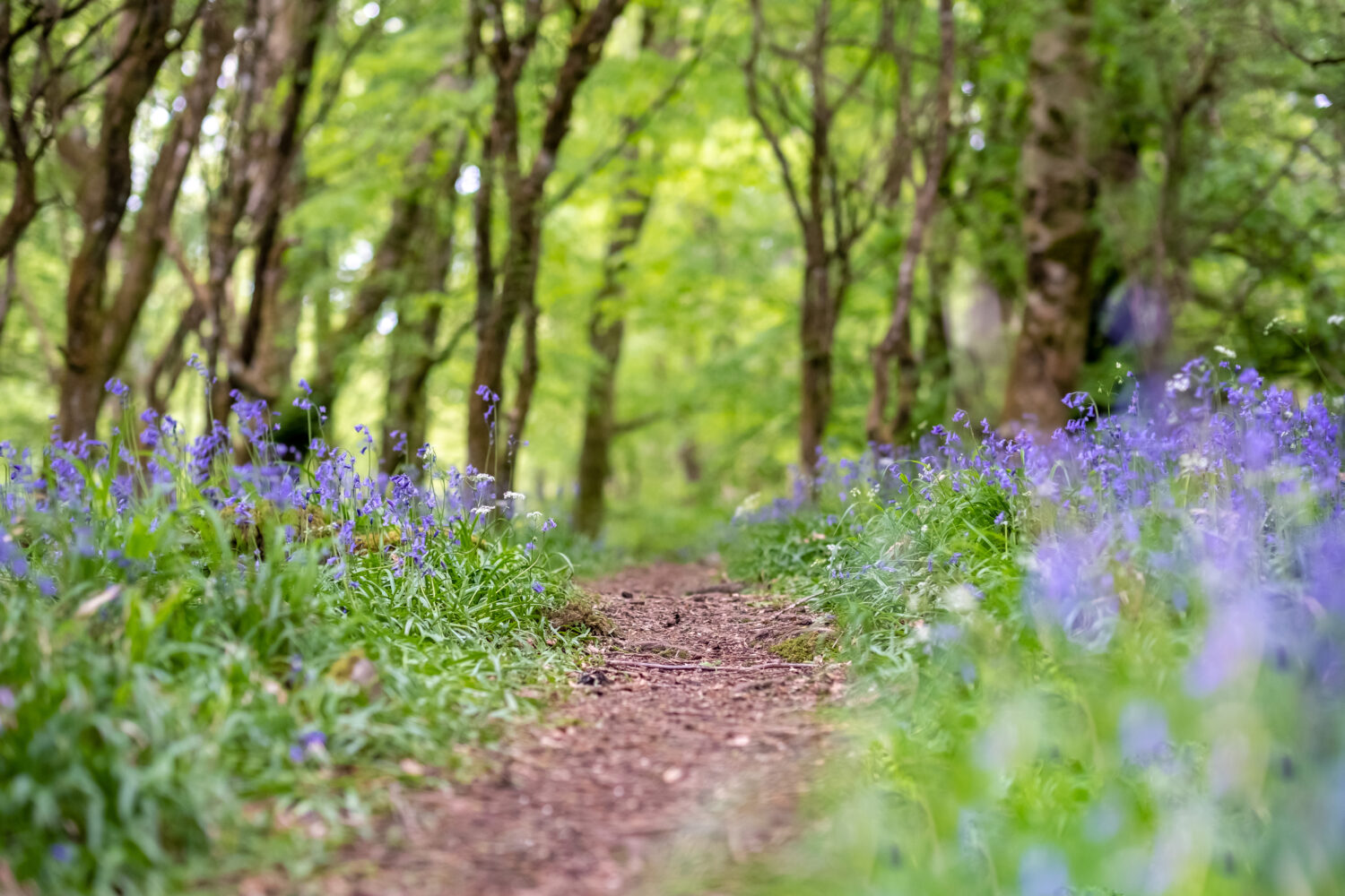
Ahh the Irish summer, it’s the stuff of legends. Those two weeks of sunlight that are often interspersed with misty rain and clouds are sometimes the most talked about weeks of the year. If you’re like me and the weather doesn’t bother the nature lover in you, getting out in the Irish countryside is the best thing to do for summer. We’ve got stunning scenery and when the sun is shining Ireland can be the greenest and the prettiest country in the world. The bounty of nature, listening to the summer birds and observing the local wildlife can often give you the lift that you need even when the weather is a bit dull. Why not combine your summer holiday with some outdoor activities such as hiking and hillwalking?
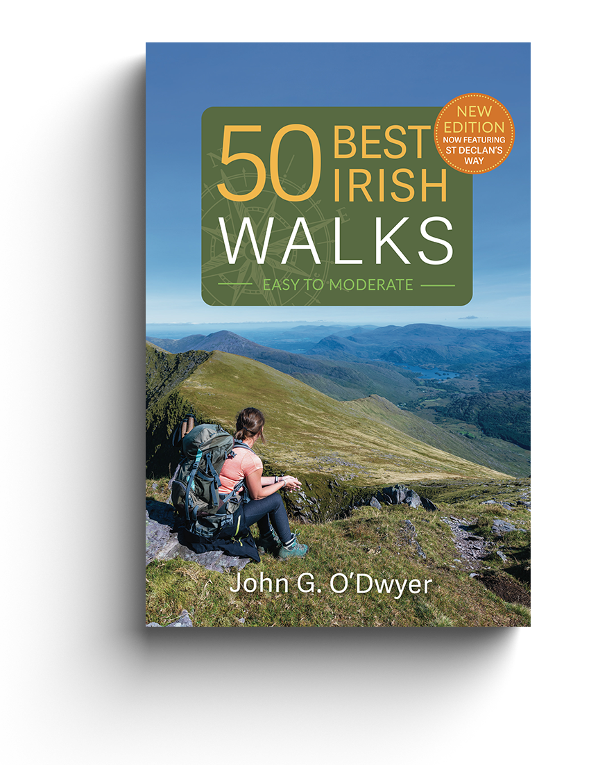
John G. O’Dwyer knows all about getting out into nature and traversing Ireland. An avid hiker and hill-walker, his travels have been well documented in his column in The Irish Times. His most recent book 50 Best Irish Walks is a handy on the go guide to the best walks in the country and some of them are nearby some fantastic hotels, BnBs and resorts which would make for the perfect summer staycation.
Check out the walking trails below which have outstanding natural beauty and are ideal for a summer break.
St Declan’s Way, North, Co. Tipperary
Who was Ireland’s first Christian missionary? Waterford folk will almost universally reply – and many historians will agree – that it was not Patrick, but Declan of Ardmore. Soon, however, he was disconcerted to hear accounts of a newly arrived, British-born evangelist, who was also preaching the gospel. To sort this out, legend has it that the southern saint travelled from Ardmore to royal Cashel to meet St Patrick. Here, it was agreed that he would have unchallenged authority over the Deise, while Patrick would become primate of all Ireland – so face was saved on both sides.
St Declan’s Way has 3 stages north of Mount Melleray Abbe. These are now fully waymarked with the blue St. Declan’s Way arrows and the Slí Dheaglain signposts at important junctions.
Those wishing to have evidence of completing the entire pilgrim path can obtain a St Declan’s Way passport free of charge and stamp it at the designated points on the route.
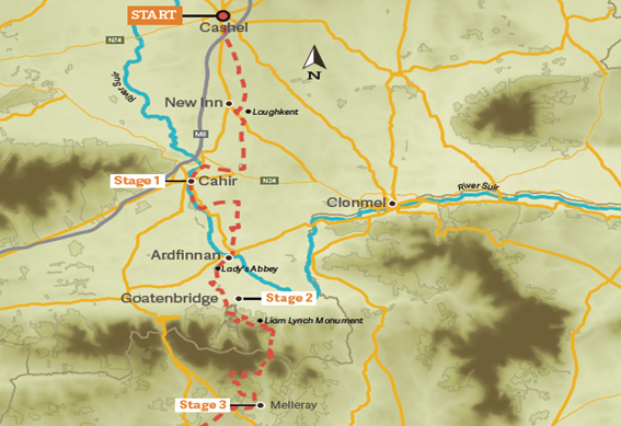
Time: 3 days
Distance: 59Km
Terrain: Ancient trail leading from Cashel, Co Tipperary to Mount Melleray Abbey, Co Waterford. Stages 1 and 2 are unchallenging with generally hill-free going on terrain that consists of quiet roads, riverside paths and rustic lanes. Stage 3 is somewhat more challenging with a fairly continuous, but never over-demanding, ascent to the Liam Lynch Monument. Beyond, the route levels out before rising to gain the Tipperary/Waterford border and then descending to a memorable finish at Mount Melleray Abbey.
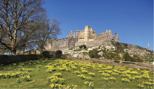
Stage 1 – Cashel to Cahir, 21km
Starting from the iconic Rock of Cashel, go by a ruined Dominican Abbey and the magnificent 18th century Church of Ireland Cathedral before passing through a modern sculpture that marks a sallyport in the medieval walls of Cashel and finishing this first leg at historic Cahir.
Stage 2 – Cahir to Goatenbridge, 18km
Begin from beside the ramparts of the great Butler Castle that dominates the town and is well worth a pre-walk visit. Continue by following the River Suir south to reach the ornamental bridge leading to the Swiss Cottage. Then, it is on through the picturesque village of Ardfinnan located beneath a 12th century Norman Castle that once guarded an important crossing point on the River Suir. Finally, you pass the ruins of the medieval Lady’s Abbey, before crossing the Tar River by a pretty footbridge and ending near Goatenbridge.
Stage 3 – Goatenbridge to Mount Melleray Abbey, 20km
After a steady upward ascent on benign forest paths, you reach a large round tower constructed to honour republican leader Liam Lynch, who was shot here during the Irish Civil War. Beyond lies Byrnes Bridge. Here, a sweeping, off-road descent leads to the renowned Cistercian Abbey at Mount Melleray. Make sure to visit the magnificent monastery church to appreciate its great vaulted ceiling and glorious stained-glass window.
Portumna Forest Park, Co. Galway
Portumna Forest Park in Co. Galway is a lovely deciduous forest filled with native Irish trees and plants. The park’s history should not be overlooked as the forest is situated near the grounds of Portumna Castle, it was the seat of the de Burgo family for centuries. Portumna Castle was the family seat held by the Earls of Clanricarde who ruled over east and central Galway. The Castle is a fine example of a 17th century fortified home, and is well worth making the diversion for a guided tour during its summer time opening period.
As Portumna lies of Lough Derg, Portumna Harbour is only a stone’s throw away from the park and castle grounds. The area is a wonder of natural beauty, there’s also a local golf course and many other amenities nearby. The quaint town of Portumna itself is within a mile of the park and harbour, with lots of lovely little shops and a hotel.
Time: 3 hours
Distance: 14km
Getting there: The starting point is the Yew Walk in the town of Portumna, Co. Galway, which lies close to the junction for the N65 to Loughrea.
Suitability: This is a low-level walk containing almost nothing in terms of hills and no special skills are required to complete it. Just follow the directions from the town to the trailhead. Here, be led by the red arrows denoting the Bonaveen Loop.
Map: The appropriate Ordnance Survey map is Discovery Sheet 53, but you won’t need it as the circuit is clearly marked.
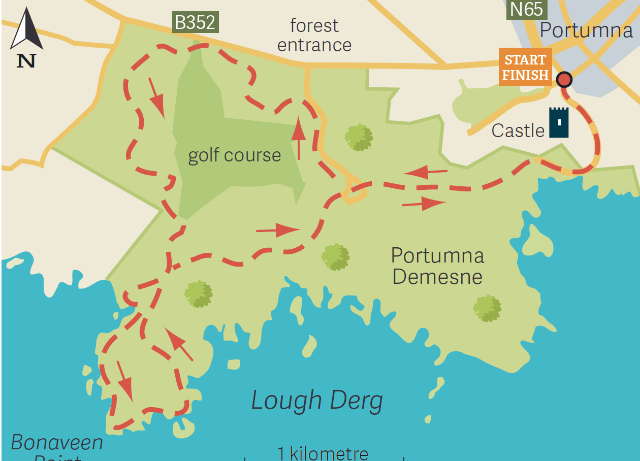
Portumna Forest Park is being carefully restored to oak, ash and hazel woodland as part of an admirable native-trees preservation scheme. The forest trail has a clearing with map boards, toilets, car parking and picnic tables.
Bonaveen Trail is billed as the longest and most picturesque loop walk, and is denoted with red arrows. This trail, which is maintained by the state forestry company Coillte, is well laid out with – fair play to them – an absence of those vertigo-inducing tubular metal stiles that are now common on many Irish walkways. There are wooden swinging gates along with boardwalks and tiny, well-constructed bridges that fit unobtrusively into the landscape.
The trail takes us past Portumna Golf Club and continues through pleasant mixed woodlands before passing near a forest- enclosed turlough.
Family friendly and accessible, Portumna Forest Park is the perfect place to spend a short family staycation whilst admiring the native plant life of county Galway and exploring some Irish history too while you’re at it.
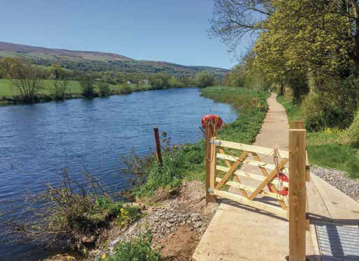
Suir Blueway, Co. Tipperary
Time: 4 hours
Distance: 21km
Getting there: The Blueway begins from Healy Park, Carrick-on-Suir, which is located on the left-hand side of the N24, Clonmel Road.
Suitability: An undemanding outing with good underfoot conditions throughout and no route-finding skills required. You will, however, need a friend or a taxi to drop you out to the start point or collect you at the end.
Map: Not necessary, just follow the river bank.
Greenways are highly successful at getting people into the Irish countryside. In recent years, these have been joined by a series of blueways. Newbies to the Irish outdoors, these don’t even demand wet feet to experience the treasures of Ireland’s inland waterways, since most offer waterside paths. A new one had just opened to link Carrick-on- Suir with Clonmel that entirely followed the banks of the River Suir. This memorable pathway was for many years partially closed due to access problems but has now re-emerged as one of Ireland’s finest waterside excursions. Exploring this seemed the perfect ramble for a day’s outing.
Indeed, renowned 19th century athlete Maurice Davin, who later became the first President of the GAA, hailed from a prosperous a Carrick-on-Suir family that owed its affluence to a river trading business. The sweep of the great waterway now leads through rich lands which provided the wealth to construct the churches, castles and tower houses that populate the riverbank. A solitary
boatman punted languorously downstream at the MSD industrial complex, which should not be seen as an unwelcome intrusion but as a huge employer and good example of late 20th century building technology.
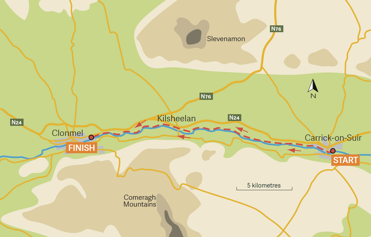
One thing is certain, the Suir Blueway still remains one of Ireland’s most rewarding waterside walks and situated near the picturesque town of Clonmel it’s an ideal attraction for those wanting a quiet countryside holiday for the summer.
The solitude the river weaves its tranquil spell, for a waterside is more a state of mind than a place. There is something calming about following a riverbank by tuning to the soporific sounds and ageless appeal of the waterside. In wavy river light, trout rise languidly, an impertinent moorhen burst forth to break the stillness, while a pair of statuesque herons stood silent and watchful for prey.
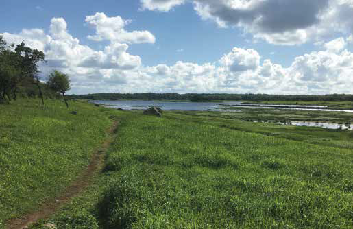
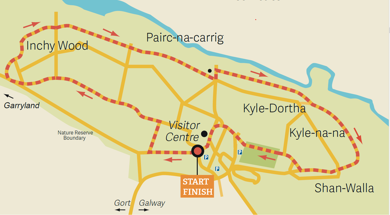
Coole Park, Co. Galway
Time: 2 hours
Distance: 5km
Getting there: Coole Park is located 4km north-west of the town of Gort, Co. Galway. It is signposted from exit 16 on the M18 motorway.
Suitability: A very easy circuit following walker friendly terrain.
Map: Available from the visitor centre.
For those literature lovers, there is no other place like Coole Park, Co. Galway for inspirition. Among his vast collection, William Butler Yeats’ ‘The Wild Swans of Coole’ is a favourite poem for many and Coole park is the place that did much to stimulate the poet’s artistic imaginings.
Once the home of Lady Augusta Gregory, she was renowned in her day as a dramatist, folklorist and co-founder of the Abbey Theatre, and her stately house in County Galway was at the centre of the Irish Literary Revival. It acted as a spiritual home and wellspring of creativity for many giants of Irish literature including Yeats, Shaw, Synge and O’Casey.
Setting out from the well-designed visitor centre, trees part to reveal an aquamarine lake of intense beauty in a basin of deep green, for Coole Lough is one of Ireland’s foremost examples of a turlough. Almost unique to Ireland, these consist of small lakes bedded in porous limestone, where water levels rise and fall with startling rapidity. It was here Yeats came upon the nine-and-fifty swans that he immortalised in verse. He was referring to the whoopers that still arrive each October from Iceland to winter at Coole, although how he managed to count them so accurately seems something of a mystery at this moment.
Contemplate the charm of the lakeside and relax on a convenient rock while wondering if Yeats might have done the same.
Make sure to visit Autograph Tree of Coole. It was here, at the bidding of Lady Gregory, that the superstars of the Irish Literary Revival carved their initials into the trunk of a magnificent copper beech. The letters have, of course, faded with the passage of time, although the hugely flamboyant initials of George Bernard Shaw immediately capture the eye above the more reticent initials of Synge, Hyde, O’Casey, Russell and Gregory herself.
The county town of Gort is a short drive away where you can relax and sojourn the day away for a lovely literary tour of the west of Ireland.
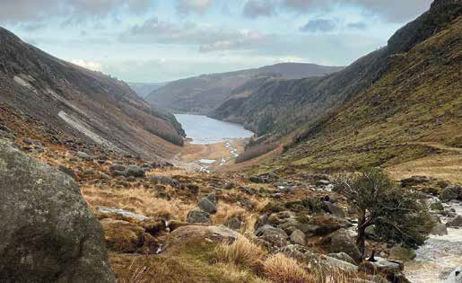
The Spink Loop, Glendalough Co. Wicklow
Time: 3.5 hours
Distance: 10km
Getting there: Take the N11 from Dublin or Wexford to Ashford. Follow the R763 to Laragh. Alternately take the R756 (Wicklow Gap) from Hollywood. Glendalough lies just west of Laragh.
Suitability: Moderately demanding walk with a steep ascent requiring reasonable fitness. Navigation skills unnecessary; just follow the white arrows.
Map: OSi, sheet 56
Travel up the Kings River Valley and over the Wicklow Gap to the Vale of Glendasan, for the landscape remains delightfully desolate. Beyond is the unforgettable embrace of Glendalough – the valley of the two lakes where an early Christian monastic settlement was founded by St Kevin in the 6th century. The surrounding landscape reminds of a scene created in an ethereal dream.
On the Wicklow Way Poulanass Waterfall is a pretty little cascade that has carved deep ravines into the underlying bedrock.
Following the white arrows for the Spink Loop along a forest track. Next comes a seemingly interminable boardwalk ascent through dense conifers before I escape their claustrophobic embrace. Hauntingly airy views over Glendalough’s Upper Lake are well worth the hike and perfect for a quiet escape from the stresses of city life.
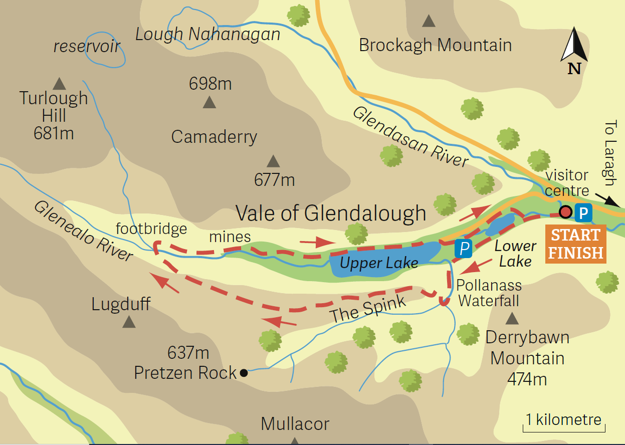
Enjoying great panoramic views down the full length of the Glendalough valley. This is the granite end of Glendalough and is so tough is the rock that the river has failed to carve out a waterfall, and so the waters descend in a series of swirling rapids.
As the home of St Kevin, after journeying to Glendalough to escape the world and devote his life to prayer and sacrifice as a hermit, tradition holds, this was the saint’s first spartan abode. It is certainly an isolated and difficult to access lair, but Kevin’s escape plan came badly unstuck, nevertheless.
His reputation for piety was such that many others followed in his wake and created the renowned monastic city further down the valley, which flourished as a centre of learning and pilgrimage for over six centuries and continued to exist up to the time of the Reformation. And Glendalough still remains a spiritual destination with the tradition of pilgrimage continuing to the present day. 21st century pilgrims still wend their way over the ancient trail across the Wicklow Gap from Hollywood and Valleymount while treading some of the original paving stones laid down for the medieval roadway.
Despite Dublin’s seemingly unstoppable expansion – the proximity of the city has impacted little on the Wicklow landscape. Glendalough’s haunting beauty still sets it apart in the 21st century as it did in the time of St Kevin.
Giant’s Causeway, Co. Antrim
Time: 1.5 hours
Distance: 5km
Getting there: The Giant’s Causeway is located on the B147 Causeway road, Co. Antrim. It is two miles from Bushmills and 13 miles from Ballycastle.
Suitability: An unchallenging outing on reasonably sound tracks. Shepherds Steps can be slippery.
Note: At the time of writing, admission to the Giant’s Causeway was free, but parking cost a whopping £12.50 per person or £11 online. With a full car, you may wish to park in Bushmills and take public transport. After 6pm parking was free at the Causeway.
Map: OSNI Activity Map, Causeway Coast and Rathlin Island.
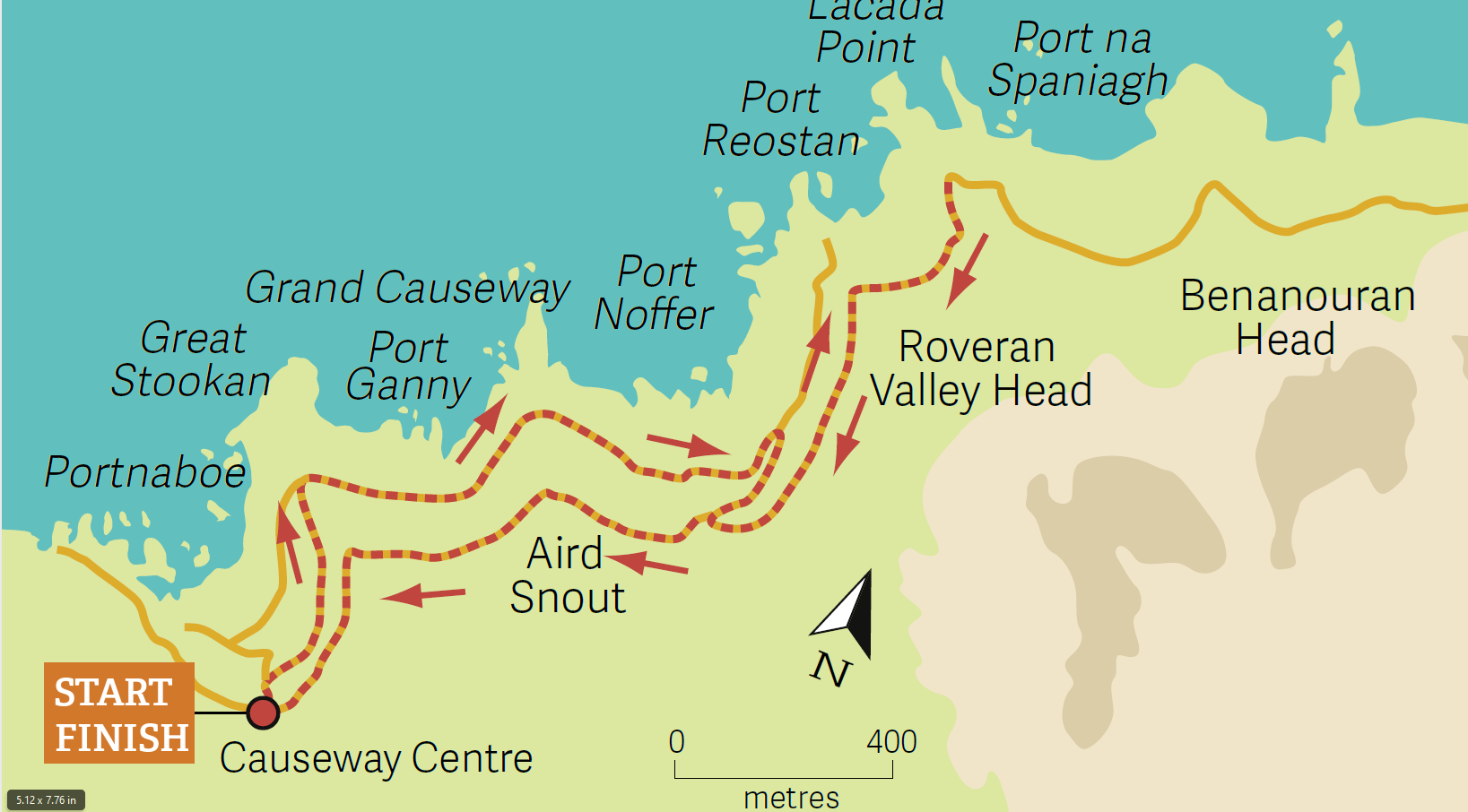
Take a wonderful weekend break at the Causeway Hotel in Co. Antrim where downhill on the route is the world famous Giant’s Causeway. A UNESCO World Heritage Site, it’s so named because it was the legendary place of a fight between Fionn MacCumhaill and Scottish giant Benandonner. When Fionn disguised himself as a baby, Benandonner ran home back to Scotland in fear and his massive feet broke the ground and created the unique rock formations we see today.
Visible on the horizon from the Giant’s Causeway is Donegal’s Malin Head, the northernmost place in Ireland. You can walk east in Northern Ireland while gazing north at Southern Ireland.
It is thus how the complexity of Irish history has convoluted its geography.
The otherworldliness of all 37,000 mostly hexagonal columns give the impression of a huge manmade causeway leading out from the cliff foot to disappear under the ocean.
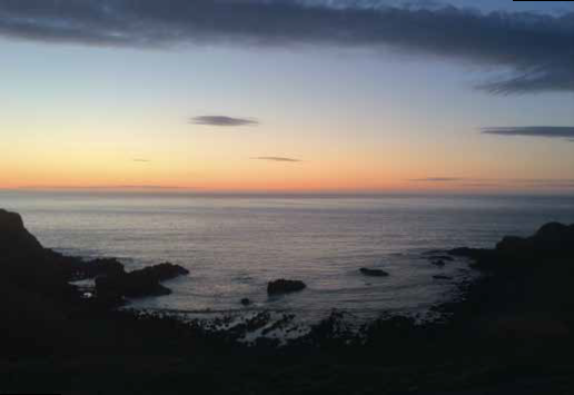
You can watch the sun slowly drop in a fiery globe to drown itself spectacularly in the north-western ocean.
These black basalt columns, it occurs to me that here is by far Ireland’s most insanely evocative coastline. The surreal atmosphere of the Giant’s Causeway makes for glorious moments of calm with a wild writhing surrounding sea.
All of these walks and many more fantastic sites for the prefect Irish nature getaway are outlined in John G. O’Dwyer’s brand new book, 50 Best Irish Walks.